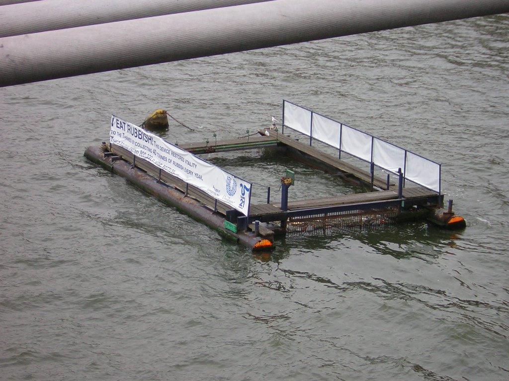
On the side it says "I Eat Rubbish." It seems to be some sort of trash collecting filter thing, but I haven't been able to find any information on how it works. Here it is on Google Maps.
A bit up stream we can see this set of structures:
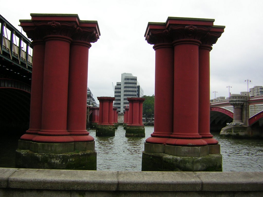
An interesting set of structures, don't you think? A look from the satellite helps to show that these columns line up with the bridge on the left. Is it coming down, or going up, or halfway between?
No comments:
Post a Comment
Note: Only a member of this blog may post a comment.